
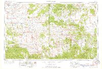
1958 Map of Saint Johns
USGS Topo · Published 1958About this map
The Little Colorado River and its tributaries define the high plateau and mountain landscapes of this mid-century survey, which straddles the Arizona New Mexico border. Water management is a central theme of the region's development, evidenced by the Lyman Reservoir south of Saint Johns and Becker Lake near the community of Springerville-Eagar. To the north, the Atchison Topeka and Santa Fe railroad tracks cut across the arid terrain near Holbrook, providing a vital transit link alongside U. S. 66.
Find a feature on this map
66 named features on this map. Tap any name to fly to it.
Don’t see what you’re looking for? This feature index may not catch every label — zoom into the map to look around manually.
Map Details
Editions of this 1958 Saint Johns Map
2 editions found
Other maps of this area

1883 · Mt. Taylor
USGS Topo · 1:250,000

1883 · Tusayan
USGS Topo · 1:250,000

1886 · St Johns
USGS Topo · 1:250,000

1886 · Wingate
USGS Topo · 1:250,000

1886 · Mt. Taylor
USGS Topo · 1:250,000

1886 · Tusayan
USGS Topo · 1:250,000

1886 · Fort Defiance
USGS Topo · 1:250,000

1886 · Holbrook
USGS Topo · 1:250,000

1892 · Fort Defiance
USGS Topo · 1:250,000

1892 · St Johns
USGS Topo · 1:250,000