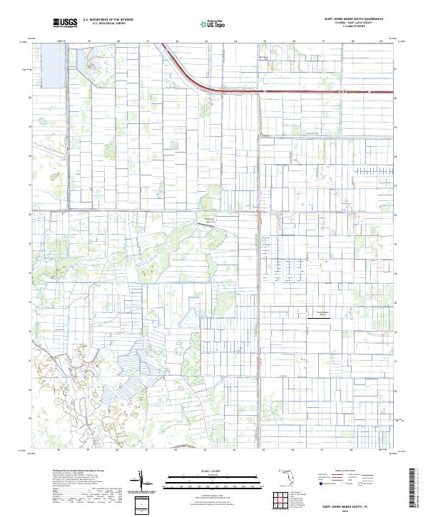
2024 Map of Saint Johns Marsh South
USGS Topo · Published 2024About this map
Agricultural development and rural aviation define this contemporary look at northwestern Saint Lucie County. The landscape is characterized by an extensive network of drainage canals and irrigation ditches, such as the Rim Ditch, which support the region's historic citrus industry. Roads like Minute Maid Rd reflect this agricultural heritage, while the presence of Dragonfly Airport and Southeastern Airport highlights the importance of private aviation in managing these large tracts of land. A grid of local connectors including Co Rd 68, Sneed Rd, and Schumann Rd provides access through the marshy terrain, which is organized into the township and range divisions of t35s r38e. The persistence of names like Pineapple Ln points to the diverse horticultural roots of the Florida interior.
Find a feature on this map
20 named features on this map. Tap any name to fly to it.
Don’t see what you’re looking for? This feature index may not catch every label — zoom into the map to look around manually.
Map Details
Editions of this 2024 Saint Johns Marsh South Map
This is the sole edition of this map. No revisions or reprints were ever made.
Other maps of this area

1949 · Oslo
USGS Topo · 1:24,000

1949 · Fort Pierce NW
USGS Topo · 1:24,000

1950 · Fort Pierce NW
USGS Topo · 1:24,000

1950 · Oslo
USGS Topo · 1:24,000

1953 · Okeechobee 1 SE
USGS Topo · 1:24,000

1953 · Fellsmere 4 SE
USGS Topo · 1:24,000

1953 · Fellsmere 4 SW
USGS Topo · 1:24,000

1953 · Okeechobee 1 SW
USGS Topo · 1:24,000

1953 · Okeechobee 1 NE
USGS Topo · 1:24,000

1953 · Okeechobee 1 NW
USGS Topo · 1:24,000