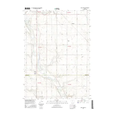
2015 Map of Saint Joseph
USGS Topo · Published 2015About this map
The East Fork Des Moines River winds through this section of northern Iowa, defining a landscape of agricultural tradition along the boundary of Kossuth and Humboldt Counties. The community of St. Joseph sits near the river's path, anchored by Saint Joseph's Catholic Cem, while the settlement of Galbraith is located to the northeast. The terrain's modification for large-scale farming is evident through an extensive system of engineered waterways, including Drainage Ditch Number 116, Drainage Ditch Number 182, and Drainage Ditch Number 8.
Find a feature on this map
47 named features on this map. Tap any name to fly to it.
Don’t see what you’re looking for? This feature index may not catch every label — zoom into the map to look around manually.
Map Details
Editions of this 2015 Saint Joseph Map
This is the sole edition of this map. No revisions or reprints were ever made.
Other maps of this area

1954 · Fairmont
USGS Topo · 1:250,000

1954 · Fort Dodge
USGS Topo · 1:250,000

1957 · Fort Dodge
USGS Topo · 1:250,000

1958 · Fort Dodge
USGS Topo · 1:250,000

1958 · Fairmont
USGS Topo · 1:250,000

1972 · Algona
USGS Topo · 1:24,000

1972 · St. Joseph
USGS Topo · 1:24,000
1972 · Sexton
USGS Topo · 1:24,000
1972 · Lu Verne
USGS Topo · 1:24,000

1972 · Livermore
USGS Topo · 1:24,000