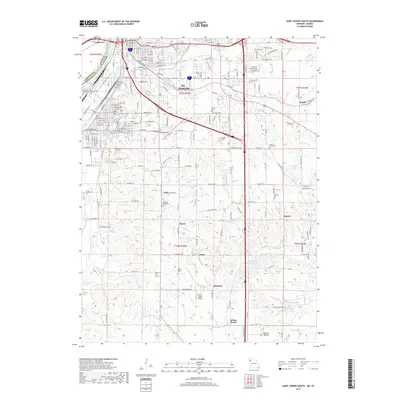
2017 Map of Saint Joseph South
USGS Topo · Published 2017About this map
St. Joseph serves as the focal point of this 2017 survey, where the urban street grid of the southern city meets the rural reaches of Buchanan County. The Missouri River defines the western edge, separating Missouri from Doniphan County, Kansas, and the community of Elwood. This landscape is particularly dense with genealogical markers, including numerous burial sites like New King Hill Cem, Walnut Grove Cem, and the historic Old Sparta Cem near the former site of Sparta.
Find a feature on this map
104 named features on this map. Tap any name to fly to it.
Don’t see what you’re looking for? This feature index may not catch every label — zoom into the map to look around manually.
Map Details
Editions of this 2017 Saint Joseph South Map
This is the sole edition of this map. No revisions or reprints were ever made.
Other maps of this area

1923 · Clarksdale
USGS Topo · 1:62,500

1924 · St. Joseph
USGS Topo · 1:62,500

1925 · Gower
USGS Topo · 1:62,500

1925 · Clarksdale
USGS Topo · 1:62,500

1926 · Saint Joseph
USGS Topo · 1:62,500

1927 · Dearborn
USGS Topo · 1:62,500

1950 · Kansas City
USGS Topo · 1:250,000

1951 · Edgerton
USGS Topo · 1:24,000
1951 · De Kalb
USGS Topo · 1:24,000
1951 · Dearborn
USGS Topo · 1:24,000