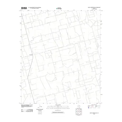
2010 Map of Saint Lawrence SE
USGS Topo · Published 2010About this map
Crossroads serves as the central point for this Reagan County landscape, where the intersection of FM 1357 and Gin Rd highlights the agricultural foundations of the region. The map reveals a highly structured grid of ranch roads and local lanes, often bearing the names of local families and residents, such as Cauble Ranch Rd, Saldiber Rd, and Weishuhn Rd.
Find a feature on this map
17 named features on this map. Tap any name to fly to it.
Don’t see what you’re looking for? This feature index may not catch every label — zoom into the map to look around manually.
Map Details
Editions of this 2010 Saint Lawrence SE Map
This is the sole edition of this map. No revisions or reprints were ever made.
Other maps of this area

1928 · Rankin
USGS Topo · 1:125,000

1954 · San Angelo
USGS Topo · 1:250,000

1958 · San Angelo
USGS Topo · 1:250,000

1965 · San Angelo
USGS Topo · 1:250,000

1970 · Stiles NW
USGS Topo · 1:24,000

1970 · Moore Hill
USGS Topo · 1:24,000

1970 · Stiles
USGS Topo · 1:24,000

1973 · Saint Lawrence SE
USGS Topo · 1:24,000

1973 · Bigby Corner
USGS Topo · 1:24,000
1973 · Slager Lake
USGS Topo · 1:24,000