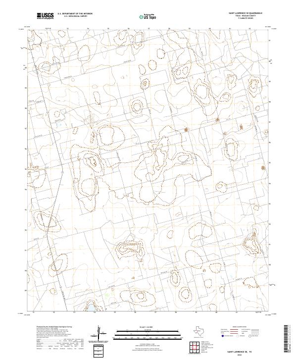
2022 Map of Saint Lawrence SE
USGS Topo · Published 2022About this map
Ranch Rd 1800 and Fm 1357 anchor this part of Reagan County, where the landscape is defined by a grid of agricultural properties and oil-related infrastructure. The map reveals a pattern of rural land use characterized by long, straight access ways like Forgotten Rd and Cotton Flat Rd that divide the West Texas terrain into large parcels. Family names are deeply embedded in the local geography, seen in routes such as Cauble Ranch Rd, Houston's Rd, and Coleman Ln. This modern survey illustrates the methodical organization of the Permian Basin region, where ranching heritage meets contemporary energy development. The network of secondary paths, including Wolf's Way and Saldivar Rd, provides a clear view of the property divisions and residential clusters that sustain this rural community southeast of Saint Lawrence.
Find a feature on this map
22 named features on this map. Tap any name to fly to it.
Don’t see what you’re looking for? This feature index may not catch every label — zoom into the map to look around manually.
Map Details
Editions of this 2022 Saint Lawrence SE Map
This is the sole edition of this map. No revisions or reprints were ever made.
Other maps of this area

1928 · Rankin
USGS Topo · 1:125,000

1954 · San Angelo
USGS Topo · 1:250,000

1958 · San Angelo
USGS Topo · 1:250,000

1965 · San Angelo
USGS Topo · 1:250,000

1970 · Stiles NW
USGS Topo · 1:24,000

1970 · Moore Hill
USGS Topo · 1:24,000

1970 · Stiles
USGS Topo · 1:24,000

1973 · Saint Lawrence SE
USGS Topo · 1:24,000

1973 · Bigby Corner
USGS Topo · 1:24,000
1973 · Slager Lake
USGS Topo · 1:24,000