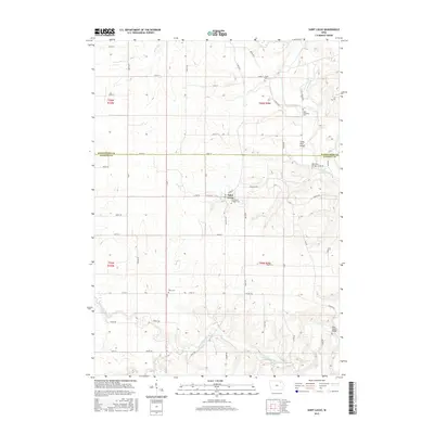
2015 Map of Saint Lucas
USGS Topo · Published 2015About this map
Saint Lucas serves as the central hub of this agricultural landscape in northeastern Iowa, where the border between Winneshiek Co and Fayette Co bisects the terrain. The community is anchored by the Saint Lukes Catholic Cem, while the surrounding countryside is marked by several smaller burial grounds including Young Cem, Saint Anthonys Cem, and Eden Cem, providing essential points of reference for genealogical research.
Find a feature on this map
61 named features on this map. Tap any name to fly to it.
Don’t see what you’re looking for? This feature index may not catch every label — zoom into the map to look around manually.
Map Details
Editions of this 2015 Saint Lucas Map
This is the sole edition of this map. No revisions or reprints were ever made.
Other maps of this area

1901 · Oelwein
USGS Topo · 1:125,000

1906 · Decorah
USGS Topo · 1:125,000

1954 · Mason City
USGS Topo · 1:250,000

1954 · Waterloo
USGS Topo · 1:250,000

1955 · Waterloo
USGS Topo · 1:250,000

1957 · Mason City
USGS Topo · 1:250,000

1958 · Mason City
USGS Topo · 1:250,000

1958 · La Crosse
USGS Topo · 1:250,000

1959 · Dubuque
USGS Topo · 1:250,000

1961 · Dubuque
USGS Topo · 1:250,000