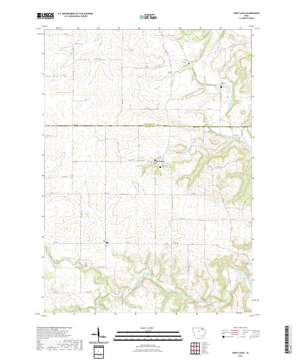
2022 Map of Saint Lucas
USGS Topo · Published 2022About this map
St. Lucas serves as the central hub of this agricultural landscape, straddling the border between Winneshiek and Fayette counties. The settlement is anchored by the Saint Lukes Catholic Cem, while the surrounding countryside is defined by a dense network of township roads and several family-linked or parish burial grounds, including the Young Cem, Saint Anthonys Cem, and Eden Cem. The terrain is deeply etched by a complex drainage system where the Turkey River and the Little Turkey River converge with smaller tributaries like Goddard Cr, Brockamp Cr, and Bass Cr. This 2022 survey illustrates the persistent rural structure of northeastern Iowa, where section lines dictate the road grid and historical community centers like Saint Lucas remain vital points of reference amidst the rolling drainage basins of the Turkey River watershed.
Find a feature on this map
59 named features on this map. Tap any name to fly to it.
Don’t see what you’re looking for? This feature index may not catch every label — zoom into the map to look around manually.
Map Details
Editions of this 2022 Saint Lucas Map
This is the sole edition of this map. No revisions or reprints were ever made.
Other maps of this area

1901 · Oelwein
USGS Topo · 1:125,000

1906 · Decorah
USGS Topo · 1:125,000

1954 · Mason City
USGS Topo · 1:250,000

1954 · Waterloo
USGS Topo · 1:250,000

1955 · Waterloo
USGS Topo · 1:250,000

1957 · Mason City
USGS Topo · 1:250,000

1958 · Mason City
USGS Topo · 1:250,000

1958 · La Crosse
USGS Topo · 1:250,000

1959 · Dubuque
USGS Topo · 1:250,000

1961 · Dubuque
USGS Topo · 1:250,000