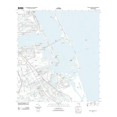
2012 Map of Saint Lucie Inlet
USGS Topo · Published 2012About this map
Port Sewall and the peninsula of Sewall Point anchor this coastal landscape where the Saint Lucie River meets the Indian River at the Saint Lucie Inlet. The map depicts a developed waterfront characterized by numerous residential neighborhoods like Golden Gate, Coral Gardens, and Skyline Heights. The transportation network is defined by several crossings, including the Ernest Lyons Bridge and Evans McCrary Bridge, which connect the mainland to the barrier islands and peninsulas.
Find a feature on this map
47 named features on this map. Tap any name to fly to it.
Don’t see what you’re looking for? This feature index may not catch every label — zoom into the map to look around manually.
Map Details
Editions of this 2012 Saint Lucie Inlet Map
This is the sole edition of this map. No revisions or reprints were ever made.
Other maps of this area

1948 · Palm City
USGS Topo · 1:24,000

1948 · Ankona
USGS Topo · 1:24,000

1948 · St. Lucie Inlet
USGS Topo · 1:24,000

1948 · Gomez
USGS Topo · 1:24,000

1948 · Hobe Sound
USGS Topo · 1:24,000

1948 · Eden
USGS Topo · 1:24,000

1949 · Gomez
USGS Topo · 1:24,000

1949 · Hobe Sound
USGS Topo · 1:24,000

1950 · St. Lucie Inlet
USGS Topo · 1:24,000

1950 · Ankona
USGS Topo · 1:24,000