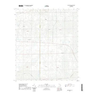
2021 Map of Saint Marks NE
USGS Topo · Published 2021About this map
The Wakulla and Jefferson County line divides this subtropical expanse, characterized by a complex network of karst topography and wetland drainage. Numerous sinkholes, including the Bear Bay Sink, Indian Camp Sink, and Big Rock Sink, suggest the underlying limestone hydrology that defines this portion of the Florida Panhandle. The landscape is a mosaic of saturated environments like Gum Swamp and Featherbed Bay, punctuated by localized elevations such as Smoky Hammock and the Sand Hills. Connectivity through this wilderness is largely limited to recreational and service routes, most notably the Florida National Scenic Trail, which traverses the southern portion of the quadrangle. Other primitive paths like the Stoney Bayou Trl and Deep Creek Trl provide access to the tidal influence of the East River and Pinhook River, revealing a region defined more by its natural hydrography than by human settlement.
Find a feature on this map
25 named features on this map. Tap any name to fly to it.
Don’t see what you’re looking for? This feature index may not catch every label — zoom into the map to look around manually.
Map Details
Editions of this 2021 Saint Marks NE Map
This is the sole edition of this map. No revisions or reprints were ever made.
Other maps of this area

1954 · Sprague Island
USGS Topo · 1:24,000

1954 · Cody
USGS Topo · 1:24,000

1954 · Woodville
USGS Topo · 1:24,000

1954 · St. Marks NE
USGS Topo · 1:24,000

1954 · St. Marks
USGS Topo · 1:24,000

1954 · Cobb Rocks
USGS Topo · 1:24,000

1954 · Valdosta
USGS Topo · 1:250,000

1954 · Tallahassee
USGS Topo · 1:250,000

1955 · Snipe Island
USGS Topo · 1:24,000

1955 · Nutall Rise
USGS Topo · 1:24,000