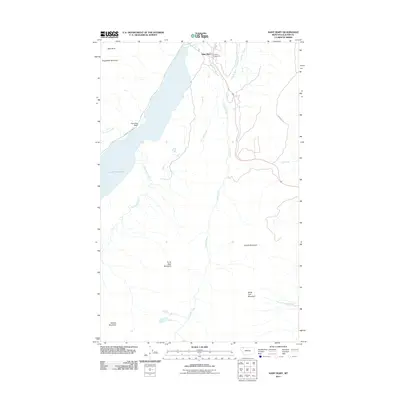
2011 Map of Saint Mary
USGS Topo · Published 2011About this map
Saint Mary serves as a focal point in this high-altitude landscape where the mountains of the Lewis Range meet the plains. The 2011 survey documents the eastern entrance to the mountains via the iconic Going To The Sun Rd, which skirts the northern shore of Saint Mary Lake. The topography is defined by significant peaks including Divide Mountain, White Calf Mountain, and Curly Bear Mountain, marking a transition from the river valleys to steep alpine terrain. Water systems are centered on the Saint Mary River and its various tributaries like Divide Creek and Red Eagle Creek, which drain the eastern slopes. Land use includes recreational infrastructure such as Johnsons Campground, situated near the confluence of the river and Fox Creek. This map offers a detailed view of the geographic corridor that facilitates travel and settlement in this corner of Glacier County, showcasing landforms like Two Dog Flats and Napi Rock.
Find a feature on this map
18 named features on this map. Tap any name to fly to it.
Don’t see what you’re looking for? This feature index may not catch every label — zoom into the map to look around manually.
Map Details
Editions of this 2011 Saint Mary Map
This is the sole edition of this map. No revisions or reprints were ever made.
Other maps of this area

1901 · Browning
USGS Topo · 1:125,000

1903 · Browning
USGS Topo · 1:125,000

1904 · Chief Mountain
USGS Topo · 1:125,000

1938 · Chief Mountain
USGS Topo · 1:125,000

1960 · Cut Bank
USGS Topo · 1:250,000

1963 · Cut Bank
USGS Topo · 1:250,000

1964 · Cut Bank
USGS Topo · 1:250,000

1968 · Saint Mary
USGS Topo · 1:24,000

1968 · Babb
USGS Topo · 1:24,000

1968 · Josephine
USGS Topo · 1:24,000