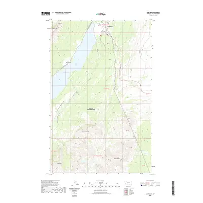
2020 Map of Saint Mary
USGS Topo · Published 2020About this map
Saint Mary serves as the gateway to the eastern edge of Glacier National Park, where high-altitude peaks and glacial waters dominate the landscape. The iconic Going-To-The-Sun Road skirts the northern shores of Saint Mary Lake and Mackinaw Bay, providing passage through a terrain defined by massive formations like Singleshot Mtn and Napi Rock. To the south, the Continental Divide National Scenic Trail winds through the high country, crossing near Curly Bear Mtn and Divide Mtn. This geography also marks a significant hydrological divide, with waters flowing toward different basins via Red Eagle Cr, Divide Cr, and the S Fork Milk River. The map captures the meeting point of recreational trails, such as the Beaver Pond Trail, and established routes like Hudson Bay Road, illustrating how modern infrastructure navigates the complex elevations of Saint Mary Ridge.
Find a feature on this map
34 named features on this map. Tap any name to fly to it.
Don’t see what you’re looking for? This feature index may not catch every label — zoom into the map to look around manually.
Map Details
Editions of this 2020 Saint Mary Map
This is the sole edition of this map. No revisions or reprints were ever made.
Other maps of this area

1901 · Browning
USGS Topo · 1:125,000

1903 · Browning
USGS Topo · 1:125,000

1904 · Chief Mountain
USGS Topo · 1:125,000

1938 · Chief Mountain
USGS Topo · 1:125,000

1960 · Cut Bank
USGS Topo · 1:250,000

1963 · Cut Bank
USGS Topo · 1:250,000

1964 · Cut Bank
USGS Topo · 1:250,000

1968 · Saint Mary
USGS Topo · 1:24,000

1968 · Babb
USGS Topo · 1:24,000

1968 · Josephine
USGS Topo · 1:24,000