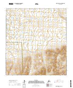
2017 Map of Saint Michael A-1 NE
USGS Topo · Published 2017About this map
Kuiak River and Kogok River define the intricate drainage patterns of this Alaskan landscape near the transition from the Nome Census Area to the Kusilvak Census Area. The 2017 survey illustrates the complex, braided nature of these watercourses as they meander through a labyrinth of wetlands and small kettle lakes. In the northeast, the Nighthawk River cuts through the low-lying terrain, highlighting the hydrological connectivity of this subarctic region. The cartography provides a precise view of the undeveloped wilderness, showing the interplay between the seasonal floodplain and the shifting boundary lines that segment this vast, roadless expanse of Western Alaska.
Find a feature on this map
8 named features on this map. Tap any name to fly to it.
Don’t see what you’re looking for? This feature index may not catch every label — zoom into the map to look around manually.
Map Details
Editions of this 2017 Saint Michael A-1 NE Map
This is the sole edition of this map. No revisions or reprints were ever made.
Other maps of this area

1951 · Unalakleet
USGS Topo · 1:250,000

1951 · St Michael
USGS Topo · 1:250,000

1952 · Saint Michael B-1
USGS Topo · 1:63,360

1952 · Saint Michael A-1
USGS Topo · 1:63,360

1952 · Unalakleet B-6
USGS Topo · 1:63,360

1952 · Unalakleet A-6
USGS Topo · 1:63,360

1952 · St Michael
USGS Topo · 1:250,000

1952 · Unalakleet
USGS Topo · 1:250,000

1964 · St. Michael
USGS Topo · 1:250,000

1964 · Unalakleet
USGS Topo · 1:250,000