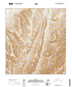
2017 Map of Saint Michael A-1 SW
USGS Topo · Published 2017About this map
Nulato Hills rise above a landscape defined by complex waterway networks in this remote section of the Kusilvak Census Area. The terrain is dominated by the wandering course of the Pikmiktalik River to the north and the Nunakogok River to the south. This 2017 survey illustrates the vast, unpopulated character of the Alaskan interior, where the primary identifiers are topographic and hydrological rather than residential. The absence of roads or settlements highlights the isolation of this region, where the natural drainage of the hills into the surrounding wetlands dictates the geography. Researchers can trace the precise contours of the hills as they descend into the river valleys, providing a detailed look at the hydrology of the Yukon delta region.
Find a feature on this map
9 named features on this map. Tap any name to fly to it.
Don’t see what you’re looking for? This feature index may not catch every label — zoom into the map to look around manually.
Map Details
Editions of this 2017 Saint Michael A-1 SW Map
This is the sole edition of this map. No revisions or reprints were ever made.
Other maps of this area

1951 · St Michael
USGS Topo · 1:250,000

1952 · Kwiguk
USGS Topo · 1:250,000

1952 · Kwiguk D-1
USGS Topo · 1:63,360

1952 · Kwiguk D-2
USGS Topo · 1:63,360

1952 · Saint Michael A-1
USGS Topo · 1:63,360

1952 · Saint Michael A-2
USGS Topo · 1:63,360

1952 · St Michael
USGS Topo · 1:250,000

1964 · St. Michael
USGS Topo · 1:250,000
2017 · Saint Michael A-2 NE
USGS Topo · 1:25,000
2017 · Saint Michael A-1 NW
USGS Topo · 1:25,000