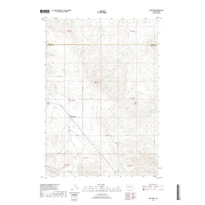
2017 Map of Saint Onge
USGS Topo · Published 2017About this map
Saint Onge serves as the central hub of this Lawrence County landscape, situated at the junction of Center St and St Onge Rd. The terrain is defined by the prominent heights of Saint Onge Peak and Baldy Peak, while the hydrological network includes curiously named watercourses such as False Bottom Cr, Stinkingwater Cr, and Oak Cr. The map reveals a high concentration of local burial sites, providing significant data for genealogists through the locations of the Saint Onge Cem, Little Dane Cem, and the Rodeo Grounds Cem. This area, just south of the Butte County line, maintains its rural character through an extensive network of named local roads like Fogelsong Rd and Sale Barn Rd, and the Bridger Canyon Trl in the southwest corner.
Find a feature on this map
37 named features on this map. Tap any name to fly to it.
Don’t see what you’re looking for? This feature index may not catch every label — zoom into the map to look around manually.
Map Details
Editions of this 2017 Saint Onge Map
This is the sole edition of this map. No revisions or reprints were ever made.
Other maps of this area

1894 · Deadwood
USGS Topo · 1:125,000

1899 · Sturgis
USGS Topo · 1:62,500

1900 · Spearfish
USGS Topo · 1:62,500

1901 · Deadwood
USGS Topo · 1:125,000

1905 · Saint Onge
USGS Topo · 1:62,500

1907 · Belle Fourche
USGS Topo · 1:125,000

1907 · Redwater
USGS Topo · 1:62,500

1915 · Spearfish
USGS Topo · 1:62,500

1915 · Sturgis
USGS Topo · 1:62,500

1916 · Deadwood
USGS Topo · 1:125,000