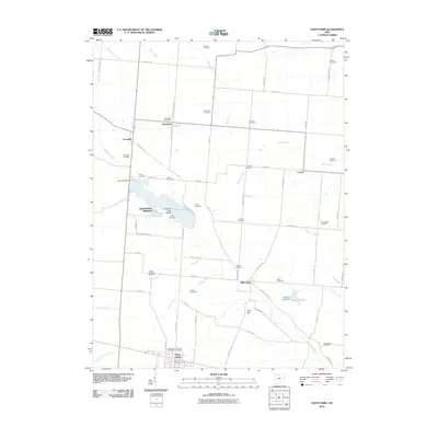
2010 Map of Saint Paris
USGS Topo · Published 2010About this map
Saint Paris anchors the southern edge of this West Central Ohio landscape, where the Saint Paris Post Office and local cemeteries like Reformed Cemetery and Lutheran Cemetery mark the community's established history. The terrain is defined by a dense network of country roads and small watercourses, including Nettle Creek and Mosquito Creek. A significant focal point is Kiser Lake, created by the Kiser Lake Dam, which features Ground Hog Island and is flanked by Grandview Heights and Camp Shawano. To the north, small unincorporated settlements such as Millerstown, Rosewood, and Carysville provide a clear view of the rural township structure. Numerous family-named burial grounds, including the Wilkson Cemetery, Halterman Cemetery, and Barger Cemetery, are scattered throughout the agricultural parcels, offering valuable geographic data for genealogists tracing regional family lineages.
Find a feature on this map
73 named features on this map. Tap any name to fly to it.
Don’t see what you’re looking for? This feature index may not catch every label — zoom into the map to look around manually.
Map Details
Editions of this 2010 Saint Paris Map
This is the sole edition of this map. No revisions or reprints were ever made.
Other maps of this area

1913 · Bellefontaine
USGS Topo · 1:48,000

1913 · Sidney
USGS Topo · 1:62,500

1914 · Troy
USGS Topo · 1:62,500

1914 · St. Paris
USGS Topo · 1:62,500

1915 · Bellefontaine
USGS Topo · 1:62,500

1916 · St. Paris
USGS Topo · 1:62,500

1944 · Sidney
USGS Topo · 1:62,500

1944 · St. Paris
USGS Topo · 1:62,500

1944 · Troy
USGS Topo · 1:62,500

1944 · Bellefontaine
USGS Topo · 1:62,500