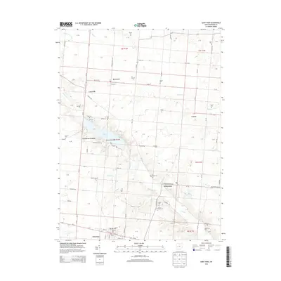
2013 Map of Saint Paris
USGS Topo · Published 2013About this map
Saint Paris anchors the southern edge of this West Central Ohio landscape, where the street grid of the village meets the rural expanses of Champaign County. The area's topography is defined by significant water bodies and glacial features, most notably Kiser Lake and the surrounding Kiser Lake State Park. Small clusters of development like Grandview Heights overlook the lake, while established rural hamlets such as Rosewood, Carysville, and Millerstown dot the surrounding farmland. These communities are connected by a network of historic routes including Oh-29 and Oh-235. Numerous burial grounds, such as Spring Grove Cem and Reformed Cem, provide deep genealogical anchors for researchers, while local landmarks like Heck Hill and Ground Hog Island add distinctive character to the terrain. The presence of smaller settlements like Crayon and Sycamore Farms illustrates the persistent agricultural and residential patterns of the region.
Find a feature on this map
121 named features on this map. Tap any name to fly to it.
Don’t see what you’re looking for? This feature index may not catch every label — zoom into the map to look around manually.
Map Details
Editions of this 2013 Saint Paris Map
This is the sole edition of this map. No revisions or reprints were ever made.
Other maps of this area

1913 · Bellefontaine
USGS Topo · 1:48,000

1913 · Sidney
USGS Topo · 1:62,500

1914 · Troy
USGS Topo · 1:62,500

1914 · St. Paris
USGS Topo · 1:62,500

1915 · Bellefontaine
USGS Topo · 1:62,500

1916 · St. Paris
USGS Topo · 1:62,500

1944 · Sidney
USGS Topo · 1:62,500

1944 · St. Paris
USGS Topo · 1:62,500

1944 · Troy
USGS Topo · 1:62,500

1944 · Bellefontaine
USGS Topo · 1:62,500