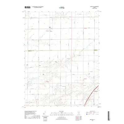
2018 Map of Saint Paul
USGS Topo · Published 2018About this map
The boundary between Fayette and Marion counties divides this rural Illinois landscape, where the small settlements of Saint Paul and Lester anchor a region defined by the winding tributaries of the Kaskaskia. The drainage patterns of the North Fork and East Fork of the Kaskaskia River dictate the local geography, punctuated by landmarks such as Lowe Mound. In the southeast corner, the edge of Kinmundy appears, providing a connection to the regional rail and road network. Numerous small family and community burial grounds, including Sandy Branch Cemetery and North Fork Cemetery, are scattered throughout the agricultural plots, reflecting the deep-rooted settlement history of the area. For genealogists, these sites and the Saint Paul Lutheran Cemetery provide specific geographic anchors for 19th and 20th-century family records.
Find a feature on this map
44 named features on this map. Tap any name to fly to it.
Don’t see what you’re looking for? This feature index may not catch every label — zoom into the map to look around manually.
Map Details
Editions of this 2018 Saint Paul Map
This is the sole edition of this map. No revisions or reprints were ever made.
Other maps of this area

1914 · Centralia
USGS Topo · 1:62,500

1934 · Salem
USGS Topo · 1:62,500

1935 · Centralia
USGS Topo · 1:62,500

1938 · Salem
USGS Topo · 1:62,500

1945 · Kinmundy
USGS Topo · 1:62,500

1945 · Vandalia
USGS Topo · 1:62,500

1947 · Vandalia
USGS Topo · 1:62,500

1947 · Kinmundy
USGS Topo · 1:62,500

1958 · Belleville
USGS Topo · 1:250,000

1962 · Belleville
USGS Topo · 1:250,000