2021 Map of Saint Paul
USGS Topo · Published 2021About this map
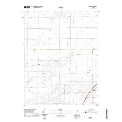
Saint Paul and Lester anchor this 2021 landscape at the border of Fayette and Marion Counties, where the drainage of the N Fork E Fork Kaskaskia River shapes the local geography. The map reveals a rural expanse defined by family and community history, evidenced by several scattered burial grounds including Saint Paul Lutheran Cem, Doolen Cem, and Sandy Branch Cem. While the town of Kinmundy occupies the southeastern corner near the intersection of Kinoka Rd and the railway, the rest of the quadrangle is a grid of country roads connecting isolated landmarks like Lowe Mound and Griffin Airport. Water features such as Flat Cr, Sandy Br, and the Patoka Club Lake offer a detailed view of the regional hydrology that has sustained these agricultural communities for generations.
Find a feature on this map
43 named features on this map. Tap any name to fly to it.
Don’t see what you’re looking for? This feature index may not catch every label — zoom into the map to look around manually.
Map Details
Editions of this 2021 Saint Paul Map
This is the sole edition of this map. No revisions or reprints were ever made.
Other maps of this area

1914 · Centralia
USGS Topo · 1:62,500

1934 · Salem
USGS Topo · 1:62,500

1935 · Centralia
USGS Topo · 1:62,500

1938 · Salem
USGS Topo · 1:62,500

1945 · Kinmundy
USGS Topo · 1:62,500

1945 · Vandalia
USGS Topo · 1:62,500

1947 · Vandalia
USGS Topo · 1:62,500

1947 · Kinmundy
USGS Topo · 1:62,500

1958 · Belleville
USGS Topo · 1:250,000

1962 · Belleville
USGS Topo · 1:250,000