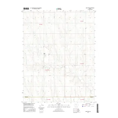
2015 Map of Saint Peter
USGS Topo · Published 2015About this map
Saint Peter serves as the central hub of this High Plains landscape, situated along the St Peter Rd corridor in Graham County. The settlement is anchored by the Saint Anthony Cem, a key landmark for local genealogists tracing the area's Catholic heritage. The terrain is defined by the winding course of the N Fork Saline River, which cuts through the southern half of the quadrangle before meeting the Saline River near the border of Trego County. To the northeast, the Leland Cem stands near the intersection of Co Rd 406, marking another point of historical interest in this agricultural region. The network of section-line roads, including Cemetary Rd and Co Rd 418, illustrates the persistent grid system that governs the movement and land use across these townships.
Find a feature on this map
23 named features on this map. Tap any name to fly to it.
Don’t see what you’re looking for? This feature index may not catch every label — zoom into the map to look around manually.
Map Details
Editions of this 2015 Saint Peter Map
This is the sole edition of this map. No revisions or reprints were ever made.
Other maps of this area

1893 · Hill
USGS Topo · 1:125,000

1954 · Goodland
USGS Topo · 1:250,000

1955 · Beloit
USGS Topo · 1:250,000

1956 · Goodland
USGS Topo · 1:250,000

1957 · Goodland
USGS Topo · 1:250,000

1959 · Beloit
USGS Topo · 1:250,000
1963 · Wa Keeney West
USGS Topo · 1:24,000

1979 · Morland
USGS Topo · 1:24,000

1979 · Penokee
USGS Topo · 1:24,000

1979 · St Peter
USGS Topo · 1:24,000