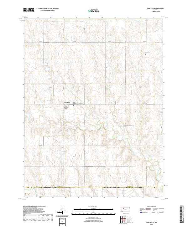
2022 Map of Saint Peter
USGS Topo · Published 2022About this map
The small community of Saint Peter sits in the high plains of northwest Kansas, serving as the central point for this agricultural landscape along the northern edge of the Saline River valley. This 2022 survey captures the area's rural character, where the township grid is punctuated by local history landmarks such as Saint Anthony Cem and Leland Cem. The terrain is defined by the dendritic drainage patterns of the N Fork Saline River and its smaller tributaries like Jackson Br, which cut into the surrounding plateau. A strictly maintained network of section-line roads, including St Peter Rd and Cemetary Rd, facilitates movement through these vast fields. At the southern map margin, the transition from Graham Co into Trego County occurs near the banks of the Saline River, illustrating the topographical shift as the land descends toward the river basin.
Find a feature on this map
19 named features on this map. Tap any name to fly to it.
Don’t see what you’re looking for? This feature index may not catch every label — zoom into the map to look around manually.
Map Details
Editions of this 2022 Saint Peter Map
This is the sole edition of this map. No revisions or reprints were ever made.
Other maps of this area

1893 · Hill
USGS Topo · 1:125,000

1954 · Goodland
USGS Topo · 1:250,000

1955 · Beloit
USGS Topo · 1:250,000

1956 · Goodland
USGS Topo · 1:250,000

1957 · Goodland
USGS Topo · 1:250,000

1959 · Beloit
USGS Topo · 1:250,000
1963 · Wa Keeney West
USGS Topo · 1:24,000

1979 · Morland
USGS Topo · 1:24,000

1979 · Penokee
USGS Topo · 1:24,000

1979 · St Peter
USGS Topo · 1:24,000