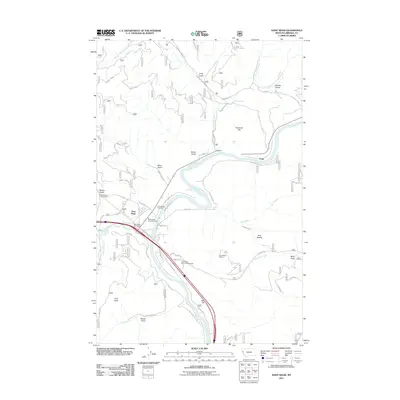
2011 Map of Saint Regis
USGS Topo · Published 2011About this map
The Clark Fork river serves as the central artery of this region, meeting the Saint Regis River at the town of Saint Regis. This 2011 survey shows a community anchored by transportation and forestry, where the Saint Regis Post Office and Saint Regis Rural Fire Dept support the local population. The map traces the winding paths of the Southside Cutoff and Old US Hwy 10, indicating the evolution of travel through the river valley.
Find a feature on this map
45 named features on this map. Tap any name to fly to it.
Don’t see what you’re looking for? This feature index may not catch every label — zoom into the map to look around manually.
Map Details
Editions of this 2011 Saint Regis Map
This is the sole edition of this map. No revisions or reprints were ever made.
Other maps of this area

1918 · St Regis
USGS Topo · 1:125,000

1919 · St. Regis
USGS Topo · 1:125,000

1956 · St Regis
USGS Topo · 1:62,500

1956 · Wallace
USGS Topo · 1:250,000

1957 · Illinois Peak
USGS Topo · 1:62,500

1959 · Plains
USGS Topo · 1:62,500

1960 · Wallace
USGS Topo · 1:250,000

1960 · Superior
USGS Topo · 1:62,500
1985 · Superior
USGS Topo · 1:24,000
1985 · Plains
USGS Topo · 1:24,000