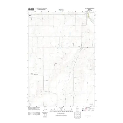
2013 Map of Saint Stephen
USGS Topo · Published 2013About this map
Saint Stephen and the neighboring agricultural settlements of Opole and Saint Wendel anchor this central Minnesota landscape in Stearns County. The terrain is defined by a network of drainage systems and small waterways, including Spunk Cr and Stony Cr, which feed toward the Mississippi River at the eastern edge of the quadrangle. This 2013 survey illustrates the interface between established farmsteads and the northward growth of Sartell. For local historians and genealogists, the map provides precise locations for family burial sites such as Mt Carmel Cem in the northwest, Saint Stephni Cem, and Saint Wendel Cem. The extensive grid of numbered county roads and avenues underscores the organized rural development that has persisted here since the nineteenth century, even as modern infrastructure like Co Hwy-17 and Co Hwy-2 connects these small communities to the larger regional hub.
Find a feature on this map
52 named features on this map. Tap any name to fly to it.
Don’t see what you’re looking for? This feature index may not catch every label — zoom into the map to look around manually.
Map Details
Editions of this 2013 Saint Stephen Map
This is the sole edition of this map. No revisions or reprints were ever made.
Other maps of this area

1948 · Pierz
USGS Topo · 1:62,500

1948 · Little Falls
USGS Topo · 1:62,500

1950 · Little Falls
USGS Topo · 1:62,500

1950 · Pierz
USGS Topo · 1:62,500

1950 · St. Cloud
USGS Topo · 1:62,500

1953 · Saint Cloud
USGS Topo · 1:250,000

1957 · Saint Cloud
USGS Topo · 1:250,000

1958 · Saint Cloud
USGS Topo · 1:250,000

1965 · St Stephen
USGS Topo · 1:24,000

1965 · Holdingford
USGS Topo · 1:24,000