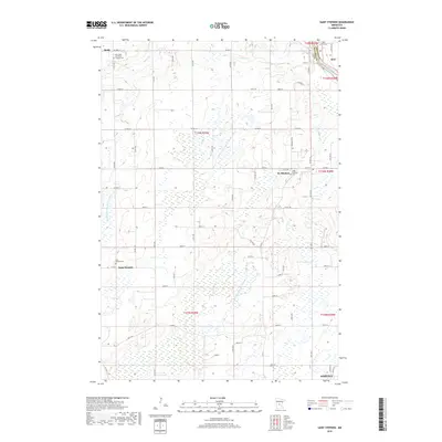
2019 Map of Saint Stephen
USGS Topo · Published 2019About this map
The Mississippi River forms the northeastern boundary of this Central Minnesota landscape, where the rural townships of Stearns and Benton counties meet. The settlement of St. Stephen serves as a central hub, flanked by the Saint Stephani Cem and characterized by a network of local roads like Main St E and Central Ave N. To the west and south, the communities of Opole, Saint Wendel, and the northern reaches of Sartell reveal a pattern of established farmsteads and parish life, anchored by sites such as Our Lady of Mount Carmel Cem and Saint Wendel Cem.. The terrain is defined by a complex drainage system, including Spunk Cr and Stony Cr, alongside engineered waterways such as County Ditch Number Twelve and County Ditch Number Eighteen. This network of ditches illustrates the extensive land management required for agriculture in this glaciated region.
Find a feature on this map
76 named features on this map. Tap any name to fly to it.
Don’t see what you’re looking for? This feature index may not catch every label — zoom into the map to look around manually.
Map Details
Editions of this 2019 Saint Stephen Map
This is the sole edition of this map. No revisions or reprints were ever made.
Other maps of this area

1948 · Pierz
USGS Topo · 1:62,500

1948 · Little Falls
USGS Topo · 1:62,500

1950 · Little Falls
USGS Topo · 1:62,500

1950 · Pierz
USGS Topo · 1:62,500

1950 · St. Cloud
USGS Topo · 1:62,500

1953 · Saint Cloud
USGS Topo · 1:250,000

1957 · Saint Cloud
USGS Topo · 1:250,000

1958 · Saint Cloud
USGS Topo · 1:250,000

1965 · St Stephen
USGS Topo · 1:24,000

1965 · Holdingford
USGS Topo · 1:24,000