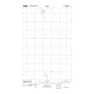
2011 Map of Saint Thomas
USGS Topo · Published 2011About this map
Saint Thomas serves as the primary hub of this eastern North Dakota agricultural landscape, organized by the precise grid of the Jeffersonian survey system. The town's layout is clearly defined by central corridors like Main St and Prairie View St, reflecting a community built around the transit and commerce of the Red River Valley. To the south, the smaller settlement of Auburn sits along Auburn Dr, while the surrounding terrain is marked by a network of drainage infrastructure like County Ditch Number 87D and the natural winding path of Willow Creek. Genealogists will find historical value in the presence of Saint Johns Cemetery and Landstad Cemetery, which serve as quiet landmarks among the expansive farm sections and rural roads such as 81st St NE.
Find a feature on this map
26 named features on this map. Tap any name to fly to it.
Don’t see what you’re looking for? This feature index may not catch every label — zoom into the map to look around manually.
Map Details
Editions of this 2011 Saint Thomas Map
This is the sole edition of this map. No revisions or reprints were ever made.
Other maps of this area

1939 · Glasston
USGS Topo · 1:62,500

1941 · Glasston
USGS Topo · 1:62,500

1943 · Grafton
USGS Topo · 1:62,500

1944 · Crystal
USGS Topo · 1:62,500

1952 · Thief River Falls
USGS Topo · 1:250,000

1956 · Thief River Falls
USGS Topo · 1:250,000

1957 · Thief River Falls
USGS Topo · 1:250,000

1960 · Grafton
USGS Topo · 1:24,000
1960 · Oakwood
USGS Topo · 1:24,000

1963 · Crystal SE
USGS Topo · 1:24,000