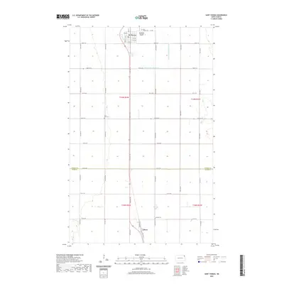
2020 Map of Saint Thomas
USGS Topo · Published 2020About this map
St. Thomas serves as the primary hub in this Red River Valley landscape, characterized by its traditional grid of streets like Main St and Park St. The surrounding agricultural terrain is defined by an extensive drainage network, including County Ditch Number 67D and County Ditch Number 67A, which are essential for managing the flat prairie land. For genealogists, the map identifies three distinct burial sites: Saint Thomas Cem north of town, Saint Johns Cem to the west, and Landstad Cem near the southern boundary. Small-scale infrastructure like the St Thomas Municipal Airport and the settlement of Auburn near the Walsh Co line reflect the region's rural development patterns. The layout of section lines and range roads illustrates the enduring impact of the Public Land Survey System on North Dakota's geography.
Find a feature on this map
35 named features on this map. Tap any name to fly to it.
Don’t see what you’re looking for? This feature index may not catch every label — zoom into the map to look around manually.
Map Details
Editions of this 2020 Saint Thomas Map
This is the sole edition of this map. No revisions or reprints were ever made.
Other maps of this area

1939 · Glasston
USGS Topo · 1:62,500

1941 · Glasston
USGS Topo · 1:62,500

1943 · Grafton
USGS Topo · 1:62,500

1944 · Crystal
USGS Topo · 1:62,500

1952 · Thief River Falls
USGS Topo · 1:250,000

1956 · Thief River Falls
USGS Topo · 1:250,000

1957 · Thief River Falls
USGS Topo · 1:250,000

1960 · Grafton
USGS Topo · 1:24,000
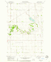
1960 · Oakwood
USGS Topo · 1:24,000

1963 · Crystal SE
USGS Topo · 1:24,000