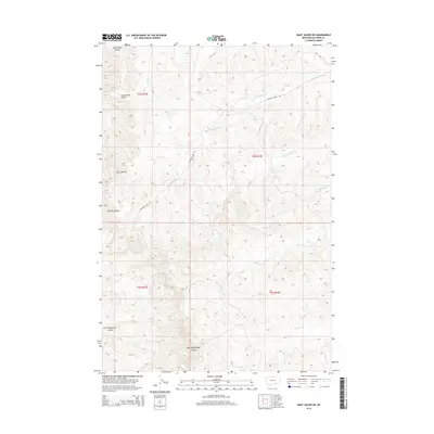
2014 Map of Saint Xavier NE
USGS Topo · Published 2014About this map
Shoulder Blade Road winds across this Big Horn County landscape, tracking the drainage of Shoulder Blade Cr through a network of deeply etched coulees and seasonal streams. This part of the Crow Indian Reservation is characterized by its high-plateau drainage patterns, where named topographic features like Good Horse Coulee and Scott Coulee define the movements of both water and traveler. The nomenclature here often reflects personal or descriptive markers, from Ox Yoke Coulee in the southwest to the eastern reaches of Bear-in-Middle Cr.
Find a feature on this map
15 named features on this map. Tap any name to fly to it.
Don’t see what you’re looking for? This feature index may not catch every label — zoom into the map to look around manually.
Map Details
Editions of this 2014 Saint Xavier NE Map
This is the sole edition of this map. No revisions or reprints were ever made.
Other maps of this area

1894 · Rosebud
USGS Topo · 1:125,000

1894 · St. Xavier
USGS Topo · 1:125,000

1894 · Fort Custer
USGS Topo · 1:125,000

1901 · Rosebud
USGS Topo · 1:125,000

1901 · St. Xavier
USGS Topo · 1:125,000

1954 · Hardin
USGS Topo · 1:250,000

1957 · Hardin
USGS Topo · 1:250,000

1958 · Hardin
USGS Topo · 1:250,000

1960 · Schick Ranch
USGS Topo · 1:24,000

1960 · St Xavier
USGS Topo · 1:24,000