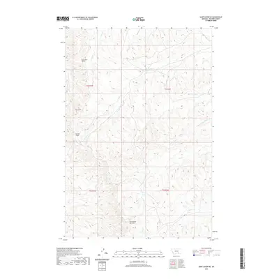
2020 Map of Saint Xavier NE
USGS Topo · Published 2020About this map
Good Horse Coulee and Scott Coulee carve through this landscape of Big Horn County, Montana, revealing a complex network of ephemeral drainages and deep ravines. The terrain is defined by its series of coulees—including Ox Yoke Coulee and the specifically named East Dipping Vat Coulee—which suggest a history of livestock management and natural water catchment. This 2020 survey captures the hydrological layout of the region, where Shoulder Blade Cr and Onion Cr serve as primary collectors for the surrounding slopes. Other named watercourses like Bear-in-Middle Cr and Mud Springs Cr flow toward the east, following the natural tilt of the land. The absence of modern towns or dense road networks emphasizes the open, agricultural character of this portion of Montana, where place names are derived from the physical features of the land rather than human settlements.
Find a feature on this map
14 named features on this map. Tap any name to fly to it.
Don’t see what you’re looking for? This feature index may not catch every label — zoom into the map to look around manually.
Map Details
Editions of this 2020 Saint Xavier NE Map
This is the sole edition of this map. No revisions or reprints were ever made.
Other maps of this area

1894 · Rosebud
USGS Topo · 1:125,000

1894 · St. Xavier
USGS Topo · 1:125,000

1894 · Fort Custer
USGS Topo · 1:125,000

1901 · Rosebud
USGS Topo · 1:125,000

1901 · St. Xavier
USGS Topo · 1:125,000

1954 · Hardin
USGS Topo · 1:250,000

1957 · Hardin
USGS Topo · 1:250,000

1958 · Hardin
USGS Topo · 1:250,000

1960 · Schick Ranch
USGS Topo · 1:24,000

1960 · St Xavier
USGS Topo · 1:24,000