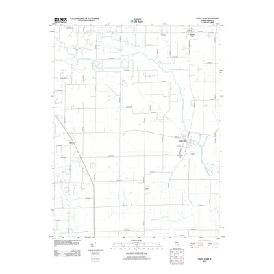
2012 Map of Sainte Marie
USGS Topo · Published 2012About this map
Sainte Marie sits at the heart of this Jasper County landscape, positioned along a sweeping bend of the Embarras River. The terrain is defined by a network of waterways that cut through the agricultural grid, including the Fox River to the west and Pond Grove Cr to the south. Small settlements like Willow Hill and Boos serve as anchors for the surrounding rural roads. Local history and genealogy researchers will find several well-documented burial sites, including the Sainte Marie City Cem, Assumption Cem, Shiloh Cem, and Edison Cem. A notable geographic landmark, the Indian Mound, is located south of the main village, suggesting the long-standing significance of this riverine landscape. The map captures the quiet persistence of these Illinois communities as they appeared in the early 21st century.
Find a feature on this map
63 named features on this map. Tap any name to fly to it.
Don’t see what you’re looking for? This feature index may not catch every label — zoom into the map to look around manually.
Map Details
Editions of this 2012 Sainte Marie Map
This is the sole edition of this map. No revisions or reprints were ever made.
Other maps of this area

1910 · Hardinville
USGS Topo · 1:62,500

1940 · Greenup
USGS Topo · 1:62,500

1941 · Newton
USGS Topo · 1:62,500

1943 · Greenup
USGS Topo · 1:62,500

1943 · Newton
USGS Topo · 1:62,500

1953 · Indianapolis
USGS Topo · 1:250,000

1956 · Indianapolis
USGS Topo · 1:250,000

1956 · Annapolis
USGS Topo · 1:62,500

1956 · Vincennes
USGS Topo · 1:250,000

1957 · Indianapolis
USGS Topo · 1:250,000