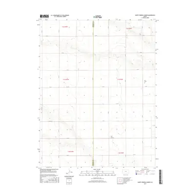
2015 Map of Sainte Theresa Church
USGS Topo · Published 2015About this map
Saint Theresa Cem and the surrounding high plains of western Kansas define this landscape along the border of Greeley and Wichita Counties. This 2015 survey reveals a strictly organized section-line grid of rural routes, including Co Rd 1995 and the long east-west stretch of Four Mile Rd. The area is characterized by its agricultural geometry, where large tracts of land are partitioned by roads like Co Rd 24 and Co Rd 26. Aside from the namesake religious site, Pearl Cem serves as a small, isolated landmark in the southern portion of the quadrangle. This documentation is essential for those researching the enduring layout of rural townships and the precise locations of small family or community burial grounds in this part of the state.
Find a feature on this map
25 named features on this map. Tap any name to fly to it.
Don’t see what you’re looking for? This feature index may not catch every label — zoom into the map to look around manually.
Map Details
Editions of this 2015 Sainte Theresa Church Map
This is the sole edition of this map. No revisions or reprints were ever made.
Other maps of this area

1955 · Scott City
USGS Topo · 1:250,000

1958 · Scott City
USGS Topo · 1:250,000

1968 · Russell Springs 3 SW
USGS Topo · 1:24,000

1968 · Russell Springs 3 NW
USGS Topo · 1:24,000

1968 · Sharon Springs 4 NW
USGS Topo · 1:24,000

1968 · Sharon Springs 4 NE
USGS Topo · 1:24,000

1970 · Sharon Springs 4 SE
USGS Topo · 1:24,000

1970 · Sharon Springs 4 SW
USGS Topo · 1:24,000

1970 · Selkirk
USGS Topo · 1:24,000

1970 · Leoti NW
USGS Topo · 1:24,000