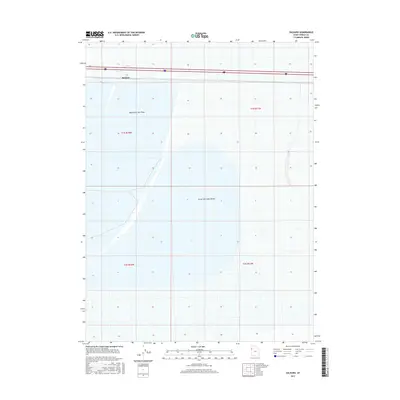
2017 Map of Salduro
USGS Topo · Published 2017About this map
Salduro stands as a focal point along the northern edge of this Tooele County survey, situated directly within the unique landscape of the Bonneville Salt Flats. The town site serves as a waypoint for travelers on Interstate 80, which cuts a linear path across the white expanse of the Great Salt Lake Desert. This environment, characterized by its extreme flatness and geological history, is defined here by its vast sections like t1s r18w and t2s r17w, which delineate the surveyed boundaries of this portion of Western Utah. The geography implies a landscape of transit and isolation, where the interstate represents the primary human footprint through the salt crust and desert floor.
Find a feature on this map
10 named features on this map. Tap any name to fly to it.
Don’t see what you’re looking for? This feature index may not catch every label — zoom into the map to look around manually.
Map Details
Editions of this 2017 Salduro Map
This is the sole edition of this map. No revisions or reprints were ever made.
Other maps of this area

1953 · Tooele
USGS Topo · 1:250,000

1955 · Tooele
USGS Topo · 1:250,000

1971 · Tetzlaff Peak
USGS Topo · 1:24,000

1971 · Bonneville Racetrack
USGS Topo · 1:24,000

1973 · Arinosa
USGS Topo · 1:24,000

1973 · Floating Island SW
USGS Topo · 1:24,000

1973 · Arinosa SW
USGS Topo · 1:24,000
1973 · Salduro SW
USGS Topo · 1:24,000

1973 · Salduro SE
USGS Topo · 1:24,000
1973 · Silsbee
USGS Topo · 1:24,000