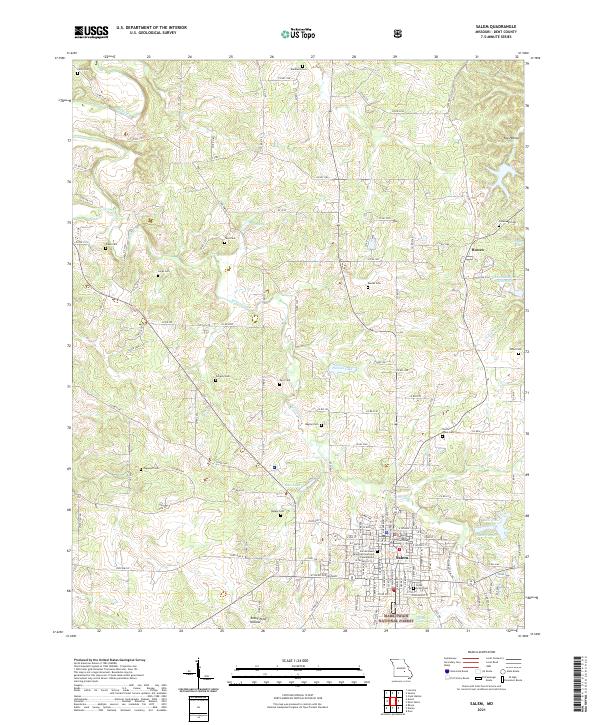
2021 Map of Salem
USGS Topo · Published 2021About this map
The Dent County Courthouse stands at the center of Salem, Missouri, anchoring a landscape where the northern reaches of the Ozarks meet the eastern edge of the Mark Twain National Forest. The map reveals a dense concentration of lineage markers, from the large North Lawn Cem and Cedar Grove Cem in town to rural family burial grounds like Gregory Cem and Togleson Cem. This area is defined by its karst topography and the headwaters of several drainages, including the Dry Fork and Spring Creek, which feed into local impoundments such as Mathes Lake and Bass Lake.
Find a feature on this map
116 named features on this map. Tap any name to fly to it.
Don’t see what you’re looking for? This feature index may not catch every label — zoom into the map to look around manually.
Map Details
Editions of this 2021 Salem Map
This is the sole edition of this map. No revisions or reprints were ever made.
Other maps of this area

1928 · Meramec Spring
USGS Topo · 1:62,500

1932 · Steelville
USGS Topo · 1:48,000

1933 · Steelville
USGS Topo · 1:62,500

1937 · Steelville
USGS Topo · 1:62,500

1941 · Salem
USGS Topo · 1:62,500

1941 · Stone Hill
USGS Topo · 1:62,500

1945 · Salem
USGS Topo · 1:62,500

1945 · Stone Hill
USGS Topo · 1:62,500

1949 · Rolla
USGS Topo · 1:250,000

1949 · Meramec Spring
USGS Topo · 1:62,500