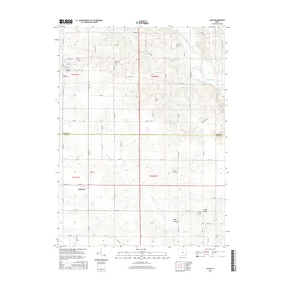
2015 Map of Salem
USGS Topo · Published 2015About this map
Salem serves as the primary hub in the northern portion of this landscape, where the street grid is defined by E Oak St and E School St. The area is notably dense with burial grounds that offer significant value for genealogical research, including the Hunting Cem near the Skunk River and the South Salem Cem on the town's outskirts. Moving south across the Henry Co Lee Co line, the landscape transitions toward the smaller communities of Houghton, Pilot Grove, and Saint Paul.
Find a feature on this map
64 named features on this map. Tap any name to fly to it.
Don’t see what you’re looking for? This feature index may not catch every label — zoom into the map to look around manually.
Map Details
Editions of this 2015 Salem Map
This is the sole edition of this map. No revisions or reprints were ever made.
Other maps of this area

1936 · Fort Madison
USGS Topo · 1:62,500

1958 · Burlington
USGS Topo · 1:250,000

1961 · Burlington
USGS Topo · 1:250,000

1963 · Burlington
USGS Topo · 1:250,000

1964 · West Point
USGS Topo · 1:24,000

1968 · Donnellson
USGS Topo · 1:24,000

1968 · Farmington
USGS Topo · 1:24,000

1980 · Lockridge East
USGS Topo · 1:24,000

1981 · Mount Pleasant
USGS Topo · 1:24,000
1981 · Lowell
USGS Topo · 1:24,000