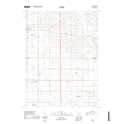
2018 Map of Salem
USGS Topo · Published 2018About this map
Salem and its surrounding rural hamlets are mapped here across the borders of Henry and Lee counties. The landscape is defined by the winding course of the Skunk River in the northeast and a network of creeks, including Sugar Cr and Fish Cr, which cut through the agricultural sections. Small settlements such as Houghton, St. Paul, and Pilot Grove serve as local anchors, each connected by a grid of numbered section roads and county routes like Co Rd W55.
Find a feature on this map
65 named features on this map. Tap any name to fly to it.
Don’t see what you’re looking for? This feature index may not catch every label — zoom into the map to look around manually.
Map Details
Editions of this 2018 Salem Map
This is the sole edition of this map. No revisions or reprints were ever made.
Other maps of this area

1936 · Fort Madison
USGS Topo · 1:62,500

1958 · Burlington
USGS Topo · 1:250,000

1961 · Burlington
USGS Topo · 1:250,000

1963 · Burlington
USGS Topo · 1:250,000

1964 · West Point
USGS Topo · 1:24,000

1968 · Donnellson
USGS Topo · 1:24,000

1968 · Farmington
USGS Topo · 1:24,000

1980 · Lockridge East
USGS Topo · 1:24,000

1981 · Mount Pleasant
USGS Topo · 1:24,000
1981 · Lowell
USGS Topo · 1:24,000