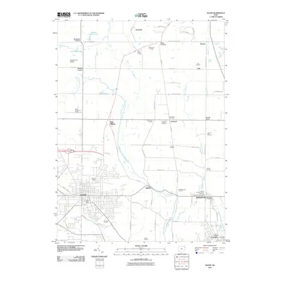
2010 Map of Salem
USGS Topo · Published 2010About this map
The industrial and agricultural heart of Columbiana County is documented here during the early twenty-first century, anchored by the dense street grid of Salem and the adjacent rail-oriented communities of Washingtonville and Leetonia. The landscape transitions from urban centers to a rural patchwork of orchards and family farms, including the White House Fruit Farm and Huffman Fruit Farm. Significant genealogical data is preserved through the mapping of numerous burial grounds, such as Bethel Methodist Episcopal Cemetery and the Old Lutheran Cemetery.
Find a feature on this map
75 named features on this map. Tap any name to fly to it.
Don’t see what you’re looking for? This feature index may not catch every label — zoom into the map to look around manually.
Map Details
Editions of this 2010 Salem Map
This is the sole edition of this map. No revisions or reprints were ever made.
Other maps of this area

1906 · Youngstown
USGS Topo · 1:62,500

1907 · Columbiana
USGS Topo · 1:62,500

1908 · Youngstown
USGS Topo · 1:62,500

1908 · Warren
USGS Topo · 1:62,500

1909 · Lisbon
USGS Topo · 1:62,500

1909 · Columbiana
USGS Topo · 1:62,500

1950 · Cleveland
USGS Topo · 1:250,000

1951 · Canton
USGS Topo · 1:250,000

1951 · Columbiana
USGS Topo · 1:24,000

1951 · Youngstown
USGS Topo · 1:24,000