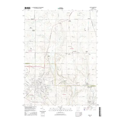
2016 Map of Salem
USGS Topo · Published 2016About this map
Salem anchors this region where the industrial character of the Mahoning and Columbiana county line meets the headwaters of the Beaver Creek watershed. The city is surrounded by a dense network of early crossroads settlements like New Albany, Greenford, and Washingtonville, many of which maintain their historical identities through local cemeteries and small-scale infrastructure. The topography is defined by the winding course of the Middle Fork Little Beaver Creek and its tributaries, including Cherry Valley Run, which cut through the hills south of the Mahoning County and Columbiana County line. Significant local landmarks such as Salem Airpark Inc and numerous historic burial grounds, including Hope Cem and Grandview Cem, offer a detailed view of the community's development and genealogy. The presence of New Albany Marsh and Western Reserve Lake highlights the varied aquatic landscape that supported both early settlement and modern conservation.
Find a feature on this map
71 named features on this map. Tap any name to fly to it.
Don’t see what you’re looking for? This feature index may not catch every label — zoom into the map to look around manually.
Map Details
Editions of this 2016 Salem Map
This is the sole edition of this map. No revisions or reprints were ever made.
Other maps of this area

1906 · Youngstown
USGS Topo · 1:62,500

1907 · Columbiana
USGS Topo · 1:62,500

1908 · Youngstown
USGS Topo · 1:62,500

1908 · Warren
USGS Topo · 1:62,500

1909 · Lisbon
USGS Topo · 1:62,500

1909 · Columbiana
USGS Topo · 1:62,500

1950 · Cleveland
USGS Topo · 1:250,000

1951 · Canton
USGS Topo · 1:250,000

1951 · Columbiana
USGS Topo · 1:24,000

1951 · Youngstown
USGS Topo · 1:24,000