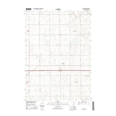
2015 Map of Salem NE
USGS Topo · Published 2015About this map
Coteau des Prairies defines the physical character of this McCook County landscape, where the high plateau rising between the Missouri and Big Sioux river valleys shapes the local topography. This 2015 survey by the U.S. Geological Survey shows a meticulously organized rural section-line system, dominated by north-south arteries like 442nd Ave and 447th Ave, and east-west thoroughfares such as 251st St and 259th St. The map illustrates the enduring grid of South Dakota's agricultural heartland, capturing the precise layout of the Township and Range system across the corners of T102N and T103N. Small wetlands and depressions scattered across the terrain highlight the glacial legacy of the region, providing a detailed view of the water drainage patterns that intersect the local road network.
Find a feature on this map
20 named features on this map. Tap any name to fly to it.
Don’t see what you’re looking for? This feature index may not catch every label — zoom into the map to look around manually.
Map Details
Editions of this 2015 Salem NE Map
This is the sole edition of this map. No revisions or reprints were ever made.
Other maps of this area

1955 · Sioux Falls
USGS Topo · 1:250,000

1958 · Sioux Falls
USGS Topo · 1:250,000

1964 · Montrose
USGS Topo · 1:24,000

1964 · Canistota
USGS Topo · 1:24,000

1964 · Salem NE
USGS Topo · 1:24,000

1964 · Salem
USGS Topo · 1:24,000

1964 · Bridgewater East
USGS Topo · 1:24,000

1964 · East Vermillion Lake
USGS Topo · 1:24,000

1968 · Lake Madison SW
USGS Topo · 1:24,000

1971 · Unityville
USGS Topo · 1:24,000