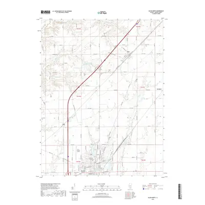
2018 Map of Salem North
USGS Topo · Published 2018About this map
The city of Salem anchors this survey of northern Marion County, showing the community as it appeared in the late 2010s. The landscape is defined by the headwaters of numerous creeks, including Town Cr and Davidson Cr, which feed into local water sources like the Salem Reservoir and the Rochester-Goodell Reservoir. Transportation infrastructure is central to the area's layout, with the Salem-Leckrone Airport and the diagonal path of the interstate cutting through the agricultural grid. Smaller settlements and historically significant stops like Alma, Tonti, and Brubaker remain distinct points on the map. Genealogists will find several burial grounds documented, such as East Lawn Cem near the city center and the more rural Hartlin Cem. Central to the town's public life is Bryan Memorial Park, providing a dedicated green space amidst the residential streets and rail-adjacent industrial corridors.
Find a feature on this map
64 named features on this map. Tap any name to fly to it.
Don’t see what you’re looking for? This feature index may not catch every label — zoom into the map to look around manually.
Map Details
Editions of this 2018 Salem North Map
This is the sole edition of this map. No revisions or reprints were ever made.
Other maps of this area

1914 · Centralia
USGS Topo · 1:62,500

1934 · Salem
USGS Topo · 1:62,500

1935 · Centralia
USGS Topo · 1:62,500

1938 · Salem
USGS Topo · 1:62,500

1945 · Kinmundy
USGS Topo · 1:62,500

1945 · Vandalia
USGS Topo · 1:62,500

1947 · Vandalia
USGS Topo · 1:62,500

1947 · Kinmundy
USGS Topo · 1:62,500

1958 · Belleville
USGS Topo · 1:250,000

1962 · Belleville
USGS Topo · 1:250,000