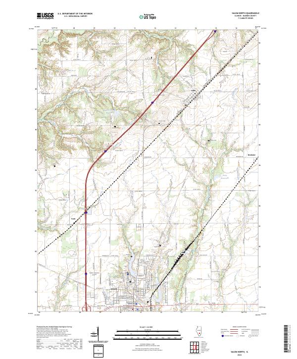
2024 Map of Salem North
USGS Topo · Published 2024About this map
Salem anchors the southern edge of this Illinois landscape, serving as the seat of local government and a center for regional travel. The Marion County Courthouse and Bryan Memorial Park mark the town's civic heart, while the Salem-Leckrone Airport and a network of county roads like Oak Grove Rd and Tonti Rd facilitate movement across the prairie. The map details a landscape defined by small settlements and family burial grounds that tell the story of rural development, including Alma, Tonti, and Brubaker. Water features such as the Rochester-Goodell Reservoir and the winding course of Crooked Creek provide geographic markers throughout the quadrangle. Genealogists will find particular value in the distribution of community cemeteries, from East Lawn Cem near town to the more remote Wilson Cem and Hartlin Cem.
Find a feature on this map
72 named features on this map. Tap any name to fly to it.
Don’t see what you’re looking for? This feature index may not catch every label — zoom into the map to look around manually.
Map Details
Editions of this 2024 Salem North Map
This is the sole edition of this map. No revisions or reprints were ever made.
Other maps of this area

1914 · Centralia
USGS Topo · 1:62,500

1934 · Salem
USGS Topo · 1:62,500

1935 · Centralia
USGS Topo · 1:62,500

1938 · Salem
USGS Topo · 1:62,500

1945 · Kinmundy
USGS Topo · 1:62,500

1945 · Vandalia
USGS Topo · 1:62,500

1947 · Vandalia
USGS Topo · 1:62,500

1947 · Kinmundy
USGS Topo · 1:62,500

1958 · Belleville
USGS Topo · 1:250,000

1962 · Belleville
USGS Topo · 1:250,000