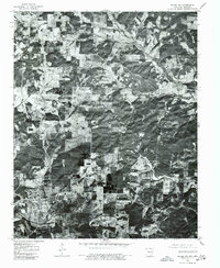
1976 Map of Salem NW
USGS Topo · Published 1977About this map
Viola serves as the primary focal point of this 1976 orthophotograph, positioned in the southwest quadrant along the crossroads of the northern Arkansas landscape. Produced through a partnership between the U.S. Geological Survey and state agencies in Arkansas and Missouri, this imagery reveals a patchwork of cleared agricultural fields and dense woodland. The orthophoto format provides a clear visual record of the rural land-use patterns in Fulton County during the mid-1970s, showing the precise footprints of homesteads and the winding paths of local roads that define the region's character. Researchers can observe the distribution of water sources and the transition between managed pastureland and the native forest cover typical of the Salem NW quadrangle area.
Find a feature on this map
1 named feature on this map. Tap any name to fly to it.
Don’t see what you’re looking for? This feature index may not catch every label — zoom into the map to look around manually.
Map Details
Editions of this 1976 Salem NW Map
This is the sole edition of this map. No revisions or reprints were ever made.
Other maps of this area

1890 · Mountain Home
USGS Topo · 1:125,000

1891 · Mountain Home
USGS Topo · 1:125,000

1894 · Mountain Home
USGS Topo · 1:125,000

1944 · West Plains
USGS Topo · 1:62,500

1944 · Cureall
USGS Topo · 1:62,500

1945 · Harrison
USGS Topo · 1:250,000

1946 · West Plains
USGS Topo · 1:62,500

1946 · Cureall
USGS Topo · 1:62,500

1949 · Harrison
USGS Topo · 1:250,000

1950 · Salem
USGS Topo · 1:62,500