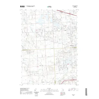
2019 Map of Salem
USGS Topo · Published 2019About this map
Novi, Northville, and Wixom anchor this landscape at the intersection of Oakland, Wayne, and Washtenaw counties. The area is defined by its complex hydrology, with the Novi Lyon Drain, Johnson Drain, and Blackwood Drain weaving through a grid of numbered roads from 5 Mile Rd up to 12 Mile Rd. In the southern reaches of the map, the small settlements of Salem and Brookville sit near family-named cemeteries that provide valuable links for genealogists, including Walker Cem, Thayer Cem, and Lapham Cem. To the east, Maybury State Park offers a dedicated network of recreation paths, including the Maybury State Park Equestrian Trail and Maybury State Park Yellow Biking Trail, showcasing how former rural lands have transitioned into protected public spaces amidst suburban growth.
Find a feature on this map
37 named features on this map. Tap any name to fly to it.
Don’t see what you’re looking for? This feature index may not catch every label — zoom into the map to look around manually.
Map Details
Editions of this 2019 Salem Map
This is the sole edition of this map. No revisions or reprints were ever made.
Other maps of this area

1902 · South Lyon
USGS Topo · 1:62,500

1904 · Ann Arbor
USGS Topo · 1:125,000

1905 · Wayne
USGS Topo · 1:62,500

1906 · South Lyon
USGS Topo · 1:62,500

1907 · Pontiac
USGS Topo · 1:62,500

1908 · Ann Arbor
USGS Topo · 1:125,000

1909 · Milford
USGS Topo · 1:62,500

1912 · Wayne
USGS Topo · 1:62,500

1936 · Wayne
USGS Topo · 1:31,680

1936 · Wixom
USGS Topo · 1:31,680
Featured Places
- Novi, MI
- Northville Charter Township, MI
- Plymouth Charter Township, MI
- Lyon Charter Township, MI
- Wixom, MI