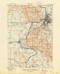
1917 Map of Salem
USGS Topo · Published 1948About this map
The Willamette River defines the landscape of this region during the early twentieth century, winding between Polk and Marion counties. The state capital of Salem sits at a transition point where the Southern Pacific railroad and early highways like the Pacific Highway meet the river's edge. Notable institutional footprints of the era are clearly marked, including the State Institution for Feeble-Minded, the Oregon State Training School, and the Poor Farm School for the Deaf. To the west, the landscape is dotted with smaller communities and agricultural hubs such as Monmouth, Independence, and Eola. The river's influence on commerce and transit is evident through numerous bars and landings like Wigrich Landing, Judson Landing, and Wells Landing, which served the local economy before the full modernization of the regional road network.
Find a feature on this map
122 named features on this map. Tap any name to fly to it.
Don’t see what you’re looking for? This feature index may not catch every label — zoom into the map to look around manually.
Map Details
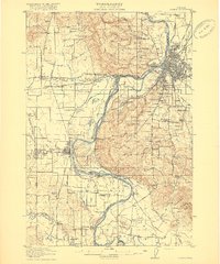
Editions of this 1917 Salem Map
3 editions found
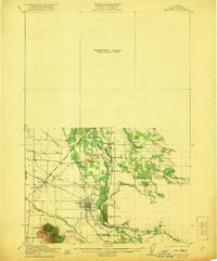
Other maps of this area

1912 · Jefferson
USGS Topo · 1:31,680

1913 · Wells
USGS Topo · 1:31,680

1914 · Independence
USGS Topo · 1:31,680

1914 · Soap Creek
USGS Topo · 1:31,680

1915 · Rickreall
USGS Topo · 1:31,680

1915 · Eola
USGS Topo · 1:31,680

1915 · Sidney
USGS Topo · 1:31,680

1916 · Albany
USGS Topo · 1:62,500

1917 · Salem
USGS Topo · 1:62,500
1921 · Lebanon
USGS Topo · 1:62,500