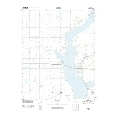
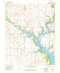
2010 Map of Salina
USGS Topo · Published 2010About this map
Salina serves as the primary hub on the eastern shore of Lake Hudson, where the Neosho River valley was transformed by mid-century water management. The town's layout reflects a lakeside economy, with residential streets like Walnut Rd and Kenwood Rd stretching toward the water's edge. Further south, the small settlement of Boatman sits near the confluence of Chapel Branch, while the northern reaches near Tip are defined by the winding course of Wolf Creek. A notable piece of regional infrastructure is the City of Tulsa Water Intake located in the northeastern corner of the lake. The topography is largely defined by the river's path, punctuated by the distinct landform of Chimney Rock Hollow to the southeast. A grid of rural roads, including E0490 Rd and N4390 Rd, provides access to the dispersed farmsteads and tributary crossings of Cabin Creek and Sulphur Creek that drain into the reservoir.
Find a feature on this map
39 named features on this map. Tap any name to fly to it.
Don’t see what you’re looking for? This feature index may not catch every label — zoom into the map to look around manually.
Map Details
Editions of this 2010 Salina Map
This is the sole edition of this map. No revisions or reprints were ever made.
Other maps of this area

1896 · Pryor
USGS Topo · 1:125,000

1901 · Pryor
USGS Topo · 1:125,000

1954 · Tulsa
USGS Topo · 1:250,000

1958 · Tulsa
USGS Topo · 1:250,000

1963 · Tulsa
USGS Topo · 1:250,000

1969 · Adair
USGS Topo · 1:24,000
1970 · Chouteau
USGS Topo · 1:24,000
1970 · Pryor
USGS Topo · 1:24,000
1971 · Salina
USGS Topo · 1:24,000
1971 · Strang
USGS Topo · 1:24,000