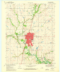
1970 Map of Pryor
USGS Topo · Published 1972About this map
Pryor serves as the focal point of this 1970 survey, revealing a well-established community defined by its civic infrastructure and educational institutions. The presence of the Whitaker State Childrens Home near Whitaker Park highlights the town's social history, while a network of schools such as Roosevelt Sch and Lincoln Sch shows the mid-century urban footprint. The Missouri-Kansas-Texas railroad cuts a diagonal path through the landscape, connecting the industrial activities at the southern edge, including a Chemical Plant and various quarries, to the regional rail network. To the south, the influence of water management is clear where Pryor Creek meets the northern reaches of the Fort Gibson Reservoir. Unusual engineering features like the Elevated Aqueduct and the local Drive-in Theater reflect the diverse land use of Mayes County during this era.
Find a feature on this map
40 named features on this map. Tap any name to fly to it.
Don’t see what you’re looking for? This feature index may not catch every label — zoom into the map to look around manually.
Map Details
Editions of this 1970 Pryor Map
2 editions found
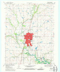
Other maps of this area

1896 · Pryor
USGS Topo · 1:125,000

1901 · Pryor
USGS Topo · 1:125,000

1954 · Tulsa
USGS Topo · 1:250,000

1958 · Tulsa
USGS Topo · 1:250,000

1963 · Tulsa
USGS Topo · 1:250,000

1969 · Adair
USGS Topo · 1:24,000
1970 · Bushyhead
USGS Topo · 1:24,000
1970 · Osage Hills
USGS Topo · 1:24,000
1970 · Chouteau NW
USGS Topo · 1:24,000
1970 · Chouteau
USGS Topo · 1:24,000