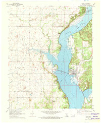
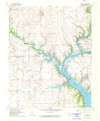
1971 Map of Salina
USGS Topo · Published 1973About this map
The town of Salina and the rural community of Boatman anchor this early 1970s landscape, where the waters of the Neosho River are contained within Lake Hudson. The infrastructure of the era is evident through the presence of the City of Tulsa Water Intake and the Grand River Pumping Station to the north. Social and spiritual life in the surrounding hills is marked by landmarks like Zion Ch, Welch Ch, and Standing Rock Ch.
Find a feature on this map
35 named features on this map. Tap any name to fly to it.
Don’t see what you’re looking for? This feature index may not catch every label — zoom into the map to look around manually.
Map Details
Editions of this 1971 Salina Map
This is the sole edition of this map. No revisions or reprints were ever made.
Other maps of this area

1896 · Pryor
USGS Topo · 1:125,000

1901 · Pryor
USGS Topo · 1:125,000

1954 · Tulsa
USGS Topo · 1:250,000

1958 · Tulsa
USGS Topo · 1:250,000

1963 · Tulsa
USGS Topo · 1:250,000
1969 · Adair
USGS Topo · 1:24,000
1970 · Chouteau
USGS Topo · 1:24,000
1970 · Pryor
USGS Topo · 1:24,000
1971 · Strang
USGS Topo · 1:24,000
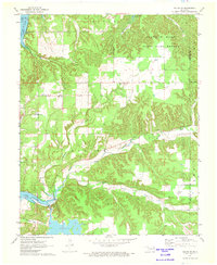
1971 · Salina SE
USGS Topo · 1:24,000