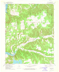
1971 Map of Salina SE
USGS Topo · Published 1973About this map
Lake Hudson and the Reservoir dominate the lower western portion of this landscape, where the Powerplant and its Penstocks mark the local utility infrastructure. The terrain rises sharply into the Spavinaw Hills, a region largely preserved as the State Game Refuge. This 1970s survey shows a rural environment defined by winding waterways like Wickliffe Creek and Saline Creek, which carve through the wooded hills. Local history is anchored by family and community landmarks such as Ross Mayes Cem and Wickliffe Sch. Religious life is evident at Blue Springs Ch and New Jordan Ch, while the City of Tulsa Water Intake on the Neosho River highlights the regional importance of these water resources. The inclusion of a Landing Field and a small Gravel Pit indicates the modest industrial and transport footprints within this quiet Oklahoma interior.
Find a feature on this map
26 named features on this map. Tap any name to fly to it.
Don’t see what you’re looking for? This feature index may not catch every label — zoom into the map to look around manually.
Map Details
Editions of this 1971 Salina SE Map
2 editions found
Other maps of this area

1896 · Pryor
USGS Topo · 1:125,000

1899 · Siloam Springs
USGS Topo · 1:125,000

1901 · Pryor
USGS Topo · 1:125,000

1903 · Siloam Springs
USGS Topo · 1:125,000

1904 · Siloam Springs
USGS Topo · 1:125,000

1954 · Tulsa
USGS Topo · 1:250,000

1958 · Tulsa
USGS Topo · 1:250,000

1963 · Tulsa
USGS Topo · 1:250,000

1971 · Kenwood
USGS Topo · 1:24,000
1971 · Salina
USGS Topo · 1:24,000