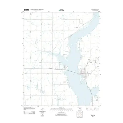
2012 Map of Salina
USGS Topo · Published 2012About this map
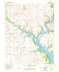
Neosho River dominates the landscape of this Mayes County region, carving a wide valley that defines the local geography. On its eastern bank, the town of Salina serves as a central hub, where residential streets like Kenwood Rd and E Pierce St meet the riverfront. The surrounding countryside is marked by small settlements such as Tip to the north and Boatman to the south, connected by a network of rural routes including Old State Hwy 20. West of the river, the terrain transitions into Rowes Prairie, drained by Sulphur Cr and Wolf Cr. The map captures a mix of agricultural expanses and wooded areas, culminating in the distinct topography of Chimney Rock Hollow in the southeast corner. This 2012 survey illustrates the modern layout of these Cherokee Nation lands, showing the integration of natural watercourses like Chapel Br with contemporary infrastructure.
Find a feature on this map
61 named features on this map. Tap any name to fly to it.
Don’t see what you’re looking for? This feature index may not catch every label — zoom into the map to look around manually.
Map Details
Editions of this 2012 Salina Map
This is the sole edition of this map. No revisions or reprints were ever made.
Other maps of this area

1896 · Pryor
USGS Topo · 1:125,000

1901 · Pryor
USGS Topo · 1:125,000

1954 · Tulsa
USGS Topo · 1:250,000

1958 · Tulsa
USGS Topo · 1:250,000

1963 · Tulsa
USGS Topo · 1:250,000

1969 · Adair
USGS Topo · 1:24,000
1970 · Chouteau
USGS Topo · 1:24,000
1970 · Pryor
USGS Topo · 1:24,000
1971 · Salina
USGS Topo · 1:24,000
1971 · Strang
USGS Topo · 1:24,000