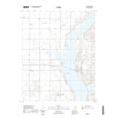
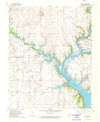
2019 Map of Salina
USGS Topo · Published 2019About this map
The Neosho River defines the geography of this area near Salina, Oklahoma, where the eastern bank rises into the distinct terrain of Chimney Rock Hollow and the western shore stretches toward Rowes Prairie. This late-era survey documents the settlement patterns of Mayes County, showing the proximity of the town of Salina to smaller outlying communities like Boatman and Tip. Local history and genealogy are well-represented by several family and community burial sites, including Bryan Chapel Cem, Zion Mennonite Cem, and Cole Cem. The landscape is a network of rural routes such as Kenwood Rd and Waterline Rd, crossing small tributaries like Wolf Cr, Sulphur Cr, and Chapel Br. This detailed record illustrates the modern development of these rural communities while maintaining clear indicators of the older place-names and land features that have long anchored this Oklahoma region.
Find a feature on this map
49 named features on this map. Tap any name to fly to it.
Don’t see what you’re looking for? This feature index may not catch every label — zoom into the map to look around manually.
Map Details
Editions of this 2019 Salina Map
This is the sole edition of this map. No revisions or reprints were ever made.
Other maps of this area

1896 · Pryor
USGS Topo · 1:125,000

1901 · Pryor
USGS Topo · 1:125,000

1954 · Tulsa
USGS Topo · 1:250,000

1958 · Tulsa
USGS Topo · 1:250,000

1963 · Tulsa
USGS Topo · 1:250,000

1969 · Adair
USGS Topo · 1:24,000
1970 · Chouteau
USGS Topo · 1:24,000
1970 · Pryor
USGS Topo · 1:24,000
1971 · Salina
USGS Topo · 1:24,000
1971 · Strang
USGS Topo · 1:24,000