2022 Map of Salina
USGS Topo · Published 2022About this map
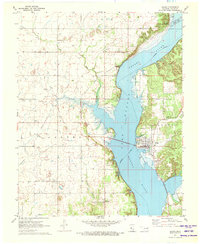
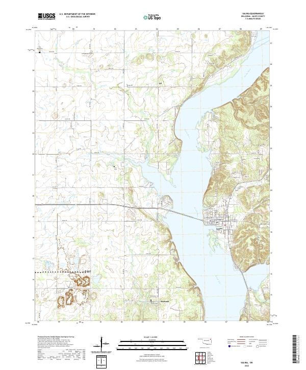
Salina serves as the primary hub of this eastern Oklahoma landscape, positioned on the east bank of the wide Neosho River. The surrounding area is defined by a series of small, dispersed communities including Tip and Boatman, reflecting a rural settlement pattern that persists into the twenty-first century. For genealogists and local historians, the map is a dense record of early burial sites such as Zion Mennonite Cem, Cole Cem, and Ross Mayes Cem. The terrain transitions from the lowlands near the river to the open expanse of Rowes Prairie in the west. Numerous watercourses, including Wolf Cr, Sulphur Cr, and Chapel Br, dissect the countryside, influencing the placement of the county road network. The layout of Salina itself is detailed, showing a clear grid of residential streets like W Carl St and W Oodle near the riverfront.
Find a feature on this map
76 named features on this map. Tap any name to fly to it.
Don’t see what you’re looking for? This feature index may not catch every label — zoom into the map to look around manually.
Map Details
Editions of this 2022 Salina Map
This is the sole edition of this map. No revisions or reprints were ever made.