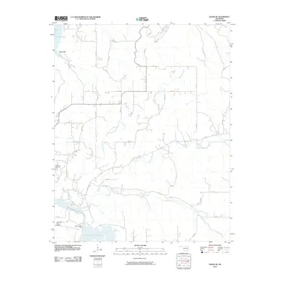
2010 Map of Salina SE
USGS Topo · Published 2010About this map
Ross Mayes Cemetery and the settlement of Hoot Owl anchor this portion of Mayes County, where the southern reaches of Lake Hudson meet the Neosho River. The landscape is defined by the significant hydrological engineering of the Chimney Rock Dam, which impounds Chimney Rock Lake at the southern edge of the quadrangle. This area is characterized by a dense network of county roads, such as Kenwood Rd and Hoot Owl Rd, that navigate the drainage basins of Wickliffe Creek and Saline Creek. The topography around Chimney Rock Hollow and the branching paths of Little Saline Creek suggest a terrain etched by water, with local routes like Chicken Hollow Rd providing access to more isolated rural sections. Genealogists and local historians can trace family land proximity to these watercourses and the cemetery, which remains a key cultural landmark in this rural Oklahoma landscape.
Find a feature on this map
44 named features on this map. Tap any name to fly to it.
Don’t see what you’re looking for? This feature index may not catch every label — zoom into the map to look around manually.
Map Details
Editions of this 2010 Salina SE Map
This is the sole edition of this map. No revisions or reprints were ever made.
Other maps of this area

1896 · Pryor
USGS Topo · 1:125,000

1899 · Siloam Springs
USGS Topo · 1:125,000

1901 · Pryor
USGS Topo · 1:125,000

1903 · Siloam Springs
USGS Topo · 1:125,000

1904 · Siloam Springs
USGS Topo · 1:125,000

1954 · Tulsa
USGS Topo · 1:250,000

1958 · Tulsa
USGS Topo · 1:250,000

1963 · Tulsa
USGS Topo · 1:250,000

1971 · Kenwood
USGS Topo · 1:24,000
1971 · Salina
USGS Topo · 1:24,000